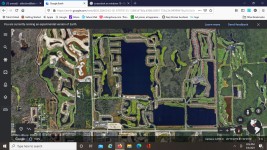
You can create an aerial using Google, similar to the attached which I created a while back. Hope this helps. I also created one for the ponds which is included in the pond section of this forum, and it has ponds numbered for easy reference within the group.